
What to See in Albania: 10 Unmissable Destinations for Your Road Trip

For more than four decades until 1985, Albania remained Europe's most isolated country under Enver Hoxha's regime. Today, this Balkan nation has opened its borders to reveal a landscape of extraordinary diversity: dramatic mountain ranges called the Albanian Alps, a stunning Mediterranean coastline known as the Riviera, crystal-clear rivers that rival Southeast Asian destinations, and a cultural heritage spanning millennia. This transformation from isolation to emerging travel destination makes Albania one of Europe's most compelling places to explore by car in 2026.
This comprehensive guide covers ten essential destinations across Albania, ordered by impact and accessibility. Whether you have one week for coastal exploration or two weeks for a full circuit including mountain passes and UNESCO sites, this itinerary provides the framework for an unforgettable Albanian road trip. Each location is connected by Albania's improving road network, with driving distances and conditions detailed to help you plan realistic daily segments.
Planning Your Albanian Road Trip: Essential Information
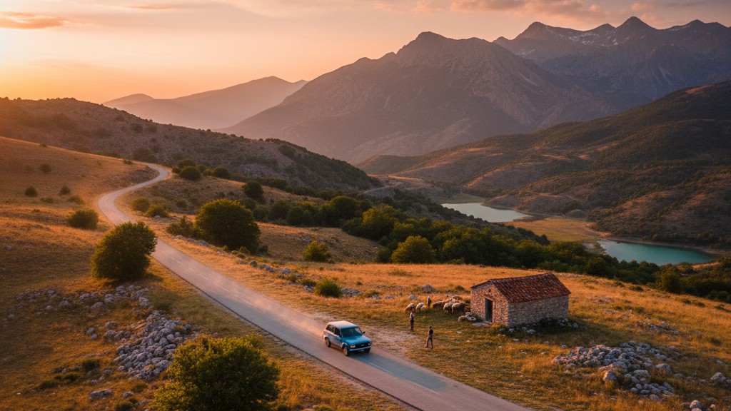
Albania requires a self-drive approach to reach its most spectacular locations. While buses and shared furgons connect major cities, natural attractions like Valbona National Park, remote beaches along the Riviera, and mountain viewpoints remain inaccessible without private transport. The road network includes limited motorway sections (A1 Tirana-Durres), well-maintained national roads (SH1, SH4, SH8), and challenging mountain routes with switchbacks, gravel sections, and narrow passages through villages.
A typical two-week itinerary covers approximately 800-1000 kilometers, with daily drives ranging from 90 minutes on motorways to four hours on mountain roads where 80 kilometers can take half a day. Summer 2026 brings increased traffic on coastal routes, particularly the SH8 between Vlora and Saranda in July and August. Drivers navigate a mix of modern roundabouts in cities and older intersections without clear priority in rural areas, requiring defensive driving throughout. Fuel stations appear regularly on main routes but become sparse in mountain regions like Valbona, where filling up before departure is essential.
Starting from Tirana International Airport Nene Tereza (IATA code TIA) at Rinas, most visitors collect rental vehicles within the terminal area or at nearby offices. The airport sits 17 kilometers northwest of central Tirana via the A1 motorway, a 25-minute drive in normal conditions. From this hub, the entire country becomes accessible: the northern mountains lie 3-4 hours north via Shkodra, the southern Riviera stretches 3.5 hours south via Vlora, and eastern cultural sites like Berat require 2 hours on the SH72 and SH3.
Ready to explore these destinations? Compare offers for car rental at Tirana airport from local Albanian companies with no hidden fees and flexible advance payment terms.
The Albanian Riviera: Turquoise Waters and White Pebble Beaches
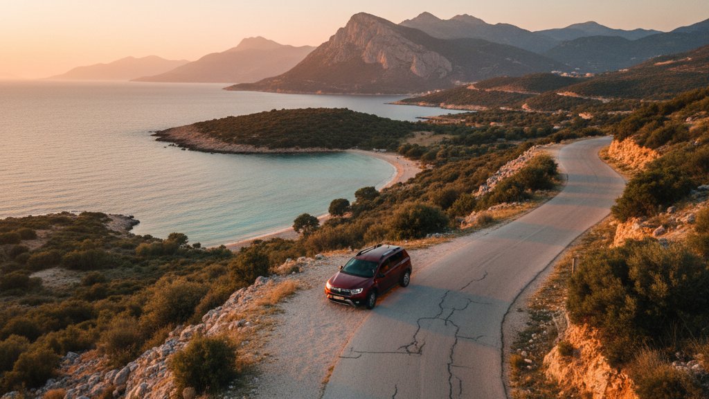
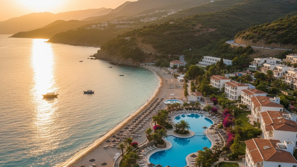
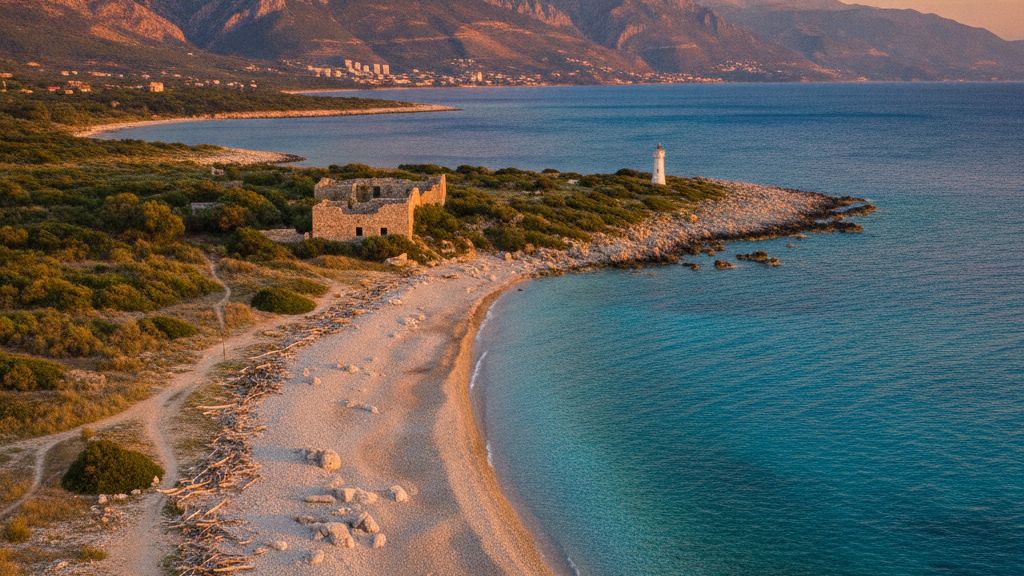
The Albanian Riviera stretches approximately 120 kilometers along the Ionian Sea from Vlora in the north to Saranda in the south, connected by the spectacular SH8 coastal road. This route crosses the Llogara Pass at 1027 meters elevation, offering panoramic views before descending to sea level through a series of dramatic switchbacks. The coastline features white pebble beaches (water shoes recommended), turquoise transparent waters with visibility exceeding 10 meters, and a backdrop of coastal mountains rising directly from the shore. Unlike the crowded beaches of neighboring Greece or Croatia, many Albanian Riviera locations remain relatively quiet even in peak August, particularly if you walk 10-15 minutes from main access points.
Himare beach represents the Riviera's best balance of accessibility, water quality, and atmosphere. The town itself has experienced significant development, with new hotels and restaurants lining the waterfront, but the beach maintains generous space even during summer. The water temperature reaches 24-26 degrees Celsius in July and August, comfortable for extended swimming without the chill of northern European waters. The beach extends for nearly two kilometers, with sections managed by different tavernas offering sun loungers (typically 5-10 euros per day) and unorganized sections where you spread your own towel on the pebbles.
Borsch beach, 30 kilometers south of Himare, offers a more compact setting with dramatic cliffs on both sides. The village maintains a traditional character with older stone houses climbing the hillside, and the beach itself measures roughly 300 meters. Access requires descending a steep footpath from the SH8, about a 10-minute walk that filters out some visitors. The water depth increases quickly from shore, making this location better for confident swimmers. Local tavernas serve fresh grilled fish and traditional byrek (savory pastry), with tables positioned directly on the beach pebbles.

Lukove beach, situated between Himare and Saranda, provides the Riviera's most secluded swimming experience. The main access point has a small parking area beside the SH8, from which a dirt path descends to the shore. Walking left or right along the coastline for 5-10 minutes leads to completely empty stretches of pebbles backed by olive groves and wild vegetation. No facilities exist here, so bring water, snacks, and shade equipment. The isolation means pristine conditions: no litter, no noise, and water that remains crystal clear throughout summer. This beach suits travelers prioritizing tranquility over convenience.
Porto Palermo beach sits within a protected bay dominated by Ali Pasha Castle, a 19th-century fortress occupying a small peninsula. The castle can be explored for a small entrance fee (approximately 200 lek), offering views across the bay and down the coastline. The beach itself curves around the bay's eastern side, with several tavernas providing loungers and food service. The protected position creates calm water conditions even when wind affects other Riviera locations. Parking requires finding space along the SH8, which becomes challenging in July and August midday periods.
Saranda serves as the logical base for exploring the southern Riviera, positioned 42 kilometers north of the Greek border at Kakavia. The town offers Albania's largest selection of accommodation in the south, from budget guesthouses to modern hotels, plus restaurants, supermarkets, medical facilities, and fuel stations. From Saranda, the furthest Riviera beaches (Himare) lie 65 kilometers north, requiring 90 minutes on the winding SH8. The town's own waterfront promenade stretches for several kilometers, lined with palm trees and offering views across to Corfu island (Greece), visible just 8 kilometers offshore. Evening xhiro (stroll) along this promenade represents an essential Albanian cultural experience.
A Note on Ksamil: Setting Realistic Expectations
Ksamil appears in countless "best beaches in Albania" lists, often with photographs showing clear turquoise waters, white sand, and the Three Islands formation. The reality during July-August 2026 differs significantly from these idealized images. Ksamil has become victim to its own popularity, experiencing overcrowding that destroys the tranquil atmosphere suggested by promotional materials. Sun loungers pack the beach in tight rows, priced at 15-25 euros (some premium spots reaching 40-50 euros), leaving virtually no space for personal towels on the sand. The parking situation adds frustration, with official lots charging 5-10 euros and unofficial attendants directing cars into olive groves for similar fees.
The water quality suffers from the concentration of bathers and the presence of numerous pleasure boats and jet skis operating close to shore. Visibility drops to 2-3 meters compared to 10+ meters at less crowded Riviera beaches. Vendors circulate constantly selling everything from corn to inflatable toys to beach umbrellas, making relaxation difficult. Beach bars compete with loud music from early morning until late evening. The photographs that promote Ksamil typically date from May, June, or September, when crowds thin and water clarity returns.
The geographic setting remains beautiful: Ksamil occupies a small peninsula within Butrint National Park, with the three small islands (Twins Island and the larger island just offshore) creating the distinctive pool-like formation. Corfu rises across the strait as a blue-green silhouette. For visitors willing to accept the crowds or visiting outside peak season, Ksamil still offers appeal. For those prioritizing swimming quality and peace, the beaches further north provide superior experiences without the hassle.
Lake Koman: Albania's Inland Fjord
Lake Koman (also spelled Komani) represents one of Albania's most dramatic landscapes, a 35-kilometer artificial reservoir created in 1985 by damming the Drin River. The lake floods a deep valley between the Accursed Mountains (Bjeshket e Nemuna in Albanian), creating a landscape resembling Norwegian fjords: steep forested slopes rising 600-800 meters directly from turquoise waters, narrow gorges where the lake measures less than 100 meters wide, and side valleys flooded to create intricate branching patterns. The lake's elevation sits at approximately 165 meters above sea level, with the surrounding peaks reaching 2000-2400 meters, ensuring dramatic vertical relief.
The primary experience involves taking the ferry from Koman village (at the dam's western end) to Fierze village (at the eastern end), a journey requiring approximately 2.5 hours. The ferry operates as practical transport connecting isolated communities and as tourist excursion. Departures typically run twice daily in each direction, with morning slots around 09:00 most reliable. The vessel accommodates vehicles, allowing travelers to drive onto the ferry at Koman, enjoy the lake scenery, and continue driving from Fierze toward Valbona National Park (approximately 45 kilometers, 1 hour additional). This routing eliminates backtracking and integrates the lake experience into a broader northern Albania itinerary.
Alternative excursions focus on the Shala River, which feeds Lake Koman from the north through a spectacular canyon. Small boats (typically 8-12 passengers) depart from various points along the lake, motoring to the Shala River mouth and continuing upstream to swimming areas in the Molla Valley. This region earns the nickname "Albanian Thailand" for its emerald-green water and jungle-like vegetation, though the comparison oversimplifies a unique landscape. The river maintains clarity throughout summer, with depth suitable for swimming and cliff jumping from rocks ranging 2-8 meters high. Several basic restaurants operate in the valley, specializing in river trout (koran in Albanian) grilled fresh.
Reaching Lake Koman requires driving from Tirana to the dam at Koman village, approximately 130 kilometers via the A1 motorway north to Vau i Dejes, then the SH30 east through rural areas. The journey takes roughly 2.5 hours, with the final 40 kilometers on a two-lane road through agricultural valleys. The village of Koman consists primarily of the dam infrastructure and a handful of guesthouses and restaurants catering to early-morning ferry passengers. Accommodation here makes sense for catching the first ferry departure without rushing from Tirana, but the village offers little beyond ferry access.
Valbona National Park: The Albanian Alps
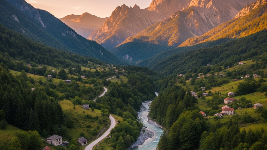
Valbona National Park occupies the northern Accursed Mountains, a section of the Dinaric Alps where peaks exceed 2600 meters and glacial valleys cut deep U-shaped profiles into the limestone. The park's centerpiece, the Valbona Valley, runs roughly 25 kilometers from the village of Valbona (elevation 800 meters) northeast toward the Jezerka peak (2694 meters), Albania's highest point. The landscape combines elements familiar from the Swiss Alps - green meadows, forest-covered slopes, scattered stone barns - with Balkan characteristics: shepherds moving flocks between seasonal pastures, traditional guesthouses serving home-cooked meals, and a network of unmarked trails known primarily to locals.
The valley's character changes with elevation. Lower sections around Valbona village (not a compact settlement but rather guesthouses spread along 8 kilometers of road) feature mixed forest of beech, oak, and pine, with meadows used for hay cultivation. The Valbona River runs transparent over white stones, cold even in August from glacial melt upstream. Higher elevations transition to subalpine meadows with wildflowers peaking in July, then to rocky terrain and permanent snowfields above 2200 meters. Wildlife includes brown bear (rarely seen), wolf, lynx, chamois, and golden eagle, though casual visitors typically encounter only smaller species.
The signature trekking route crosses from Valbona to Theth (or reverse direction), an 8-10 hour non-circular hike traversing the Valbona Pass at approximately 1800 meters elevation. This route ranks among Albania's most popular trails, combining manageable technical difficulty with spectacular scenery: panoramic views from the pass, descent through different ecological zones, and arrival in Theth valley with its traditional kulla (tower houses) and the Blue Eye spring. The trail demands reasonable fitness (1000 meters cumulative ascent, similar descent) but requires no climbing skills or specialized equipment beyond hiking boots, weather-appropriate clothing, and sufficient water. July through September offers the most reliable weather window, with June seeing residual snow on the pass and October bringing early cold snaps.
Families or less active travelers find limited options in Valbona beyond short valley walks and riverside relaxation. A trail follows the Valbona River upstream from the village for several kilometers, relatively flat and suitable for children, ending at scenic waterfalls. Swimming opportunities exist in deeper river pools, though the glacial water temperature (12-15 degrees Celsius) limits most bathers to brief dips. The mountain environment provides natural disconnection - mobile signal remains weak or absent, internet speeds can't support streaming, and evening entertainment consists of dinner at your guesthouse followed by stars undimmed by light pollution.
Accessing Valbona requires either the Lake Koman ferry route described earlier (most scenic) or a longer fully-overland route via Bajram Curri (approximately 200 kilometers and 4.5 hours from Tirana via the A1, SH5, and local roads). The final approach from Fierze to Valbona follows a narrow valley road, paved but rough in sections, requiring cautious driving. Accommodation concentrates in guesthouses and small hotels scattered along this road, most operating family-style with dinner included in the rate. The Margjeka Hotel represents the area's most developed option, offering en-suite rooms and a restaurant serving both guests and walk-ins. Booking ahead in July-August is essential, as the valley's accommodation capacity remains limited despite growing demand.
Tirana: Understanding Modern Albania Through Its Capital
Tirana serves as Albania's political, economic, and cultural center, home to approximately 500,000 residents in the city proper and 900,000 in the greater metropolitan area. The city presents a fascinating study in rapid transformation, having evolved from a quiet Ottoman-era town into a communist-planned capital, then into a post-communist city struggling with uncontrolled construction, and finally into an emerging European capital with organized public space, pedestrian zones, and cultural amenities. Understanding Tirana's layered history provides essential context for comprehending modern Albania as a whole.
Skanderbeg Square anchors central Tirana, a 40,000 square meter plaza reorganized in 2017 by Belgian architects. The square takes its name from Gjergj Kastrioti Skanderbeg (1405-1468), Albania's national hero who led resistance against Ottoman expansion in the 15th century. A massive equestrian statue of Skanderbeg dominates the square's center, with the surrounding space entirely pedestrianized and featuring geometric patterns in the pavement. The National History Museum occupies the square's northern side, identifiable by the enormous mosaic mural on its facade depicting Albanian history from ancient Illyrians through World War II resistance. The museum's chronologically organized exhibitions include Iron Age artifacts, Roman mosaics from Butrint, medieval religious icons, and a sobering section on the communist period that killed an estimated 100,000 Albanians through imprisonment, forced labor, and execution.
The communist era's paranoid isolation manifests physically in the Bunk'Art museums, two facilities converted from nuclear-proof bunkers into historical exhibitions. Bunk'Art 1, located on Tirana's outskirts in the Fadil Deliu neighborhood, occupies a massive five-story underground complex built in the 1970s for the communist leadership's wartime protection. The bunker spans more than 3000 square meters, with over 100 rooms connected by tunnels. Today these spaces house exhibitions on Albanian history 1912-1991, the communist regime's repression apparatus, and temporary art installations. The combination of historical documentation with the bunker setting itself - concrete tunnels, blast doors, decontamination rooms - creates visceral impact. Bunk'Art 2, situated near Skanderbeg Square in a smaller bunker, focuses specifically on the Sigurimi (secret police) and political persecution under communism.
These historical sites provide necessary preparation for understanding Albanian society in 2026. The country's rapid opening after decades of isolation explains both the enthusiastic embrace of tourism and Western culture and the occasionally chaotic organization that frustrates visitors expecting Western European standards. The construction boom visible in Tirana and along the coast reflects not just tourism growth but a fundamental catching up after 40 years of economic stagnation. The warmth and curiosity many Albanians show toward foreign visitors stems partly from generations denied such contact.
Practical details for visiting Tirana: the city center is compact and walkable, with most major sights within a 2-kilometer radius of Skanderbeg Square. Accommodation ranges from budget hostels to international chain hotels, with booking recommended in May-September. Parking in central areas challenges visitors, though guarded lots exist near major hotels (5-10 euros per day). The Blloku district, formerly restricted to communist elite and now the city's trendiest neighborhood, concentrates restaurants, cafes, and nightlife. Traditional cuisine worth trying includes tavakosi (lamb baked with yogurt), fergese (peppers, tomatoes, and cheese), and the ubiquitous byrek. Most museums close Mondays.
Gjirokastra: Stone City and Ottoman Heritage
Gjirokastra occupies a steep hillside in southern Albania, 120 kilometers southeast of Saranda via the SH4, a position that historically controlled the Drino Valley and routes between the coast and interior highlands. The town earns its UNESCO World Heritage designation (inscribed 2005, extended 2008) for its Ottoman-era architecture, specifically the distinctive stone houses (called kulla or stone houses) featuring projecting upper floors and stone-slab roofs that give Gjirokastra its nickname "City of Stone." Approximately 500 of these houses survive in various conditions, with the best-preserved examples open for touring in the Old Bazaar quarter.
The castle dominates Gjirokastra from the summit, a massive fortification with origins in the 12th century but primarily reflecting reconstruction under Ali Pasha of Tepelena in the early 19th century. The castle served as prison during the communist era, a history interpreted in exhibitions within its walls. The site spans approximately 8 hectares, making it one of the Balkans' largest castles, with ramparts offering panoramic views across the valley and toward the Greek border just 25 kilometers south. A captured American Air Force jet sits incongruously on the grounds, remnant of an emergency landing in 1957 during the Cold War. The castle's clock tower, galleries, and underground cistern all merit exploration, with a small military museum displaying weapons and uniforms from various periods.
Traditional houses open to the public include the Zekate House and the Skenduli House, both owned by families who maintain them as museums while residing in newer structures nearby. These houses illustrate the architectural sophistication of Ottoman-era Gjirokastra: elaborate wood ceilings, fireplaces in every room, separate hammam (bath) facilities, and economic details like the storage basement for winter provisions. The layout reflects extended family structures with separate wings for married sons and communal spaces for gathering. Guided tours (included in admission, typically 3-5 euros) explain construction techniques, social customs, and specific family histories.
Gjirokastra's Old Bazaar preserves a compact commercial quarter with stone-paved lanes, artisan workshops, and shops selling traditional textiles, copper items, and local foodstuffs. The character remains relatively authentic compared to over-touristed bazaars elsewhere in the Balkans, with actual functional workshops repairing shoes or crafting silver jewelry alongside souvenir outlets. Local specialties include qifqi (rice balls typical of Gjirokastra) and oshaf (dried figs poached with sugar and lemon). The town makes an excellent lunch stop when driving between coastal destinations and interior sites, or merits an overnight stay in one of several guesthouses converted from old stone houses.
Berat: The City of a Thousand Windows
Berat lies approximately 120 kilometers south of Tirana via the A1 and SH72, a journey of 2-2.5 hours depending on traffic through the capital. This UNESCO World Heritage Site (inscribed 2008) occupies both banks of the Osum River, with its famous white Ottoman houses climbing the hillside in dense tiers. The "thousand windows" nickname references the distinctive facade treatment: each house features multiple windows, and when viewed from distance, the hillsides appear to be composed entirely of white walls punctuated by countless dark rectangular openings. The effect proves particularly striking at dusk when interior lights begin glowing through these windows.
The Mangalem quarter fills the slope below Berat Castle on the river's left bank, a neighborhood of narrow cobblestone streets weaving between houses dating from the 18th and 19th centuries. Many remain residential, with families going about daily business - hanging laundry, tending small gardens, greeting neighbors - while tourists photograph their homes. A few houses operate as museums, including the Ethnographic Museum occupying an 18th-century structure and displaying period furniture, traditional clothing, and domestic tools. The quarter's lower reaches transition into a commercial zone with restaurants, hotels, and shops targeting visitors.
Berat Castle occupies the entire summit, unusual among Albanian castles for remaining inhabited. Approximately 100 families live within its walls, occupying houses built centuries ago and rebuilt multiple times. Visitors can wander freely through the residential areas, encountering churches, a small mosque, and the Onufri Museum housed in the Cathedral of St Mary. This museum displays works by Onufri, a 16th-century icon painter considered Albania's most important medieval artist, along with icons by other Albanian, Byzantine, and post-Byzantine painters. The characteristic Onufri red - a vibrant vermillion shade - appears throughout his work. Castle ramparts provide views across both Mangalem and the Gorica quarter on the opposite riverbank.
Practical considerations: Berat works well as a day trip from Tirana or as an overnight stop breaking longer journeys between north and south. The town offers solid accommodation options from guesthouses to boutique hotels, many converted from old houses. Parking exists near the Mangalem quarter entrance, with castle access requiring a 20-minute uphill walk on cobblestones (not vehicle accessible). Restaurant options include traditional Albanian cuisine and increasingly common pizza-pasta places targeting tourists. The town functions as a living community rather than an open-air museum, meaning certain areas have restricted access and residents deserve privacy and respect.
Butrint: Ancient Archaeological Site Near the Sea
Butrint National Park sits 18 kilometers south of Saranda, accessible via a well-maintained road along the coast and through the Vivari Channel peninsula. The park protects both a remarkable archaeological site spanning Greek, Roman, Byzantine, and Venetian periods and a surrounding wetland habitat hosting significant bird populations. UNESCO World Heritage designation (inscribed 1992, extended 1999) recognizes the site's importance as one of Albania's most complete ancient settlements, with visible remains of a theater, aqueduct, baptistery, basilica, and numerous other structures set within a forested landscape.
The archaeological site occupies a strategic hilltop overlooking the Vivari Channel and a lagoon connected to the Ionian Sea. This position provided ancient Butrint with a defensible location, maritime access, and rich fishing/farming surroundings. Greek colonists likely established the settlement in the 7th or 6th century BC, though mythology attributes earlier founding to Trojan refugees. The site flourished under Roman rule as a colony, gained importance in Byzantine times as a bishopric, and experienced final occupation by Venetians in the 15th century before abandonment due to marsh-related malaria. The combination of gradual decline rather than sudden destruction plus the isolated location preserved extensive remains.
Key structures include the Greek theater (3rd-2nd century BC), still showing seating tiers and partial scene building; the Roman baths complex with recognizable hypocaust heating system; the baptistery featuring an extraordinary 6th-century mosaic floor with animals and symbols; and the basilica with partial walls and column bases. The site spreads across approximately 16 hectares, with a recommended circuit taking 2-3 hours including time for photography and reading interpretive panels. A small museum at the entrance displays artifacts found during excavations: pottery, jewelry, statues, and architectural fragments contextualizing the structures outside.
Beyond archaeology, Butrint National Park encompasses wetlands recognized under the Ramsar Convention for their importance to migratory birds. Over 240 bird species have been recorded, including rare species like the Dalmatian pelican and pygmy cormorant. The diverse habitats - lagoons, marshes, Mediterranean scrub, oak forest - support numerous reptiles, amphibians, and mammals as well. Visiting in migration periods (April-May or September-October) offers the best wildlife viewing, though summer visits still reward observant travelers.
Practical details: entrance costs approximately 1000 lek (roughly 10 euros), with separate parking fee. The site offers minimal shade, so early morning or late afternoon visits in summer prove more comfortable. Bring water, sun protection, and appropriate footwear for uneven ancient paving. The nearby Butrint ferry crosses the Vivari Channel to Ksamil, offering an alternative route though the ferry schedule can be irregular. Combining Butrint with morning Ksamil beach time makes geographical sense despite Ksamil's previously noted drawbacks.
The Blue Eye Spring: Natural Phenomenon Near Saranda
The Blue Eye (Syri i Kalter in Albanian) ranks among Albania's most photographed natural sites, a karstic spring where water emerges from an underground river system through a striking circular pool. The spring sits approximately 30 kilometers east of Saranda via the SH81 toward Gjirokastra, then a short access road, placing it conveniently between these two major destinations. The site receives heavy visitor traffic in summer months, transforming from the peaceful natural spot of promotional images into a crowded attraction, though the underlying phenomenon remains impressive regardless of tourist numbers.
The spring's distinctive appearance comes from its depth and clarity. The water emerges from a vertical shaft exceeding 50 meters deep (the exact depth remains uncertain despite diving attempts), creating a circular pool approximately 20 meters in diameter. The deep center appears intense dark blue, almost black, while the shallower edges grade to turquoise and pale blue, creating concentric color rings. The clarity allows viewing submerged logs and rocks in remarkable detail. Water volume flowing from the spring averages 6 cubic meters per second, creating a noticeable current as it exits the pool and forms the Bistrica River. Water temperature holds steady around 10 degrees Celsius year-round, fed by underground aquifers maintaining this cold even in hot summers.
The site infrastructure includes a circular walkway allowing views from different angles, a footbridge crossing the pool's outlet, and restaurants/cafes nearby. Swimming in the spring itself is prohibited both for environmental protection and due to the dangerous currents near the underwater source. A swimming area exists downstream in the Bistrica River where current slackens, though the cold water limits most visitors to brief immersion. The surrounding forest provides welcome shade, with walking paths extending upstream and downstream along the river.
Visit timing significantly affects the experience. Arriving at opening time (typically 08:00) provides the best chance for photography without crowds obscuring views. Mid-morning through afternoon in July-August sees the site packed with tour groups and independent travelers, parking lot full, and waits for preferred photo spots. Late afternoon after tour groups depart restores some tranquility. Spring and autumn shoulder seasons offer the ideal compromise: fewer visitors, pleasant temperatures, and the spring's appearance unchanged since the water color depends on depth and clarity rather than seasonal factors.
Korce: Cultural Capital and Mountain Town
Korce occupies a high plateau at 850 meters elevation in southeastern Albania, 180 kilometers from Tirana via the SH3 and approximately 90 kilometers from the Greek border at Kapshtica. This geographic isolation in the mountains contributed to the town developing a distinct identity, historically important as a center of Albanian education and culture. Today Korce presents as a relatively prosperous provincial city with tree-lined boulevards, preserved architecture, and a cultural scene punching above its weight for a town of 75,000 residents.
The Old Bazaar quarter preserves a compact area of stone-paved lanes with traditional shops, artisan workshops, and several mosques dating from the Ottoman period. The area underwent recent restoration, improving infrastructure while maintaining historical character. The National Museum of Medieval Art occupies a former mosque, displaying an exceptional collection of Orthodox icons from churches and monasteries across southeastern Albania. The collection spans the 13th-19th centuries, showing the development of post-Byzantine painting styles with particular strength in 16th-century works. For visitors interested in Albanian Orthodox Christianity - the country's second-largest religious tradition after Islam - this museum provides excellent context.
Korce's beer culture merits mention as Albania's strongest brewing tradition centers here. Birra Korca brewery, established 1928, produces Albania's most popular beer, sold nationwide but holding special significance in its home city. The brewery operates tours (booking recommended) explaining the brewing process and history, concluding with tasting sessions. Local bars and restaurants feature Birra Korca prominently, often serving it alongside traditional meze (small plates) including pickled vegetables, white cheese, and cured meats.
The town functions as a base for exploring Prespa National Park, which Albania shares with Greece and North Macedonia. The park protects the Prespa Lakes, two interconnected alpine lakes surrounded by mountains reaching 2200 meters. The Albanian portion encompasses the western shore of Great Prespa Lake, with villages, beaches, and hiking trails. Biodiversity includes the Dalmatian pelican, a globally threatened species that breeds on the lake's islands. The drive from Korce to Prespa lakefront requires approximately 45 minutes via mountain roads, with spectacular views en route.
Korce makes sense as an overnight stop for travelers circling Albania via the southeastern route (Tirana - Korce - Gjirokastra - Saranda) rather than the more common southwestern coastal route. The town offers proper hotels, good restaurants, and a genuine local atmosphere lacking the tourist concentration of Berat or Gjirokastra. The mountain setting provides cooler summer temperatures than coastal regions, with evening temperatures dropping pleasantly even in July-August.
Shkodra: Northern Gateway and Cycling Capital
Shkodra occupies Albania's northwest, 100 kilometers north of Tirana via the A1 motorway, positioning it as the gateway to both the northern Albanian Alps and to Montenegro (the border at Hani i Hotit lies 25 kilometers north). The city counts approximately 135,000 residents, making it Albania's fourth-largest urban center, with history extending to ancient Illyrian settlement. Today Shkodra combines historical interest with practical importance as a transport hub and increasingly as Albania's cycling center.
Rozafa Castle dominates Shkodra from a rocky outcrop, its strategic position controlling the confluence of the Buna and Drin rivers. The castle's visible remains primarily reflect Venetian reconstruction in the 15th century, though foundations date to Illyrian times. The site sprawls across the rocky hilltop, with partially restored walls, towers, and cisterns. The castle courtyard contains a museum displaying archaeological finds and explaining the site's multi-layered history. Views from the ramparts span Shkodra city, Lake Shkodra to the east, and on clear days, Montenegro mountains to the north. The castle also features in Albanian legend: the name Rozafa comes from a young woman allegedly immured in the walls during construction, a sacrifice ensuring the structure's stability.
Lake Shkodra (Skadar Lake) represents the Balkans' largest lake, spanning approximately 370 square kilometers split between Albania and Montenegro. The Albanian portion holds significant biodiversity, particularly bird species, earning Ramsar Wetland designation. The shoreline northwest of Shkodra city offers swimming beaches, restaurants, and boat tour operators offering cruises through reed beds to bird-watching sites. The lake environment differs dramatically from coastal or mountain Albania, with a flatland character, fishing villages, and endemic fish species supporting local cuisine.
Shkodra's emerging reputation as Albania's cycling capital stems from flat terrain around the city, scenic routes around Lake Shkodra, and growing infrastructure including bike lanes and rental shops. Several operators offer guided bike tours ranging from half-day city circuits to multi-day trips toward Montenegro or along the lake shore. The Pedonale (pedestrian street) through central Shkodra provides car-free cycling/walking, lined with cafes and shops, pleasant for evening strolling or cycling.
FAQ: Planning Your Albanian Road Trip
How many days do I need to see the main highlights of Albania by car, covering both the coastal areas and mountain parks?
A minimum of 10-12 days allows covering Albania's essential destinations without excessive rushing. This timeframe permits visiting Tirana (1-2 days), driving to and exploring the northern mountains including Lake Koman and Valbona (3-4 days), returning through Shkodra, then heading south for the Riviera and Saranda area (3-4 days), with time for inland stops at Gjirokastra or Berat (1-2 days). Two weeks provides comfortable pacing with flexibility for weather delays on mountain roads or extra beach days. Condensed one-week itineraries are feasible but must sacrifice either mountains or extensive coast coverage.
What type of rental vehicle works best for Albanian roads considering the mix of motorways, coastal routes, and mountain access?
A standard sedan or compact SUV handles Albanian roads adequately for the routes covered in this guide. The A1 motorway and main highways (SH1, SH4, SH8) accommodate any vehicle type. Coastal roads including the Riviera's SH8 with its Llogara Pass switchbacks pose no problems for standard cars, though smaller vehicles maneuver more easily on narrow sections. Mountain access to Valbona involves rough paved roads where clearance helps but isn't essential - we drove a standard sedan throughout. High-clearance 4x4 becomes necessary only for optional off-paving exploring beyond described routes. Automatic transmission costs more but reduces driver fatigue on mountain roads.
Is it realistic to combine Albanian Riviera beach time with mountain hiking in Valbona during the same trip, given the distances involved?
Yes, combining coast and mountains works well logistically. The drive from Saranda to Tirana takes approximately 4 hours via the inland SH4 route through Gjirokastra and Tepelena, positioning you for northward travel to Shkodra and Valbona the following day. Alternatively, route from south to north by driving Saranda - Vlora - Durres - Shkodra - Valbona, keeping main roads and taking 2 days with a Durres or Shkodra overnight. The reverse routing (starting north, ending south) actually flows better, placing beach relaxation at trip end after mountain exertion. Most two-week itineraries successfully incorporate 3-4 days in northern mountains and 4-5 days on the southern Riviera.
What's the best time of year for this road trip considering both beach swimming temperatures and mountain hiking conditions?
Late May through June and September through early October represent ideal windows. June offers the best overall balance: Riviera water reaches 20-22 degrees Celsius (comfortable for most swimmers), mountain passes are snow-free, wildflowers peak in alpine meadows, and tourist crowds remain moderate. September similarly combines warm sea (23-25 degrees, warmest of the year), stable mountain weather, and diminishing crowds as schools restart. July-August deliver guaranteed hot weather and warmest swimming but bring peak crowds on the Riviera (especially Ksamil) and occasional afternoon thunderstorms in mountains. May sees cooler water (18-19 degrees) and possible residual snow on high passes like Valbona. Late October through April challenges travelers with cool/cold temperatures, reduced accommodation availability, and mountain access limited by snow.
Are there specific safety concerns driving in Albania that differ from typical European road travel?
Albanian driving culture differs from Western European norms in several ways. Overtaking on two-lane roads occurs frequently with less safety margin than typical elsewhere - expect drivers passing on curves or approaching crests. Livestock (goats, sheep, cows) wander freely along rural roads, requiring constant vigilance, particularly at dawn and dusk. Road signage can be minimal or missing entirely at rural intersections, making GPS navigation essential. Speed bumps appear without warning in villages. Conversely, actual accident rates for foreign tourists remain relatively low, partly because visitors drive more cautiously than locals. Defensive driving, assuming other drivers might do unexpected things, and never driving after dark on unfamiliar roads minimize risks effectively.
Can I visit all the destinations in this guide using only the advance payment I make when booking online, or should I expect additional costs at pickup?
The advance payment covers the basic rental for most bookings, but additional costs at pickup are common. These may include a refundable security block on your credit card (the amount varies by rental company and vehicle type, clearly stated in the voucher), additional driver fees if you want multiple drivers, optional extras like GPS or child seats, and insurance upgrades beyond the basic coverage included. Some cars labeled "no deposit" in the search results require no security block, making budgeting simpler. Always read the voucher terms carefully after booking to understand what the advance payment includes and what additional amounts might be required. The final contract at pickup specifies all charges clearly before you sign.
Comments (4)
I recently visited Albania and I can honestly say that it exceeded all my expectations. Thanks to this amazing article on the top 10 places to visit, I was able to see some of the country's most beautiful sights. From the stunning beaches of the Albanian Riviera to the historic city of Berat, every destination has its own unique charm. The hospitality of the Albanian people is also something that stood out during my trip. Overall, I highly recommend visiting Albania and exploring all it has to offer. Thank you for this wonderful guide!
Great to hear that you had a wonderful experience in Albania and found the top 10 places to visit article helpful. Albania does have so much to offer from beautiful beaches to historic cities, and the hospitality of the people is truly remarkable. Thank you for sharing your positive feedback!
Albania is a hidden gem in Europe, and these 10 places are a must-visit. The Albanian Riviera boasts beautiful beaches, crystal clear waters, and breathtaking views. The charming city of Berat, also known as the "city of a thousand windows," has stunning Ottoman architecture and a fascinating history. The ancient ruins of Butrint, a UNESCO World Heritage Site, offer a glimpse into Albanian history. In addition, the capital Tirana has a lively atmosphere, delicious food, and unique museums. Albania truly has something for everyone and should be on any traveler's list.
Certainly, Albania has much to offer and these 10 places are definitely worth a visit. From the beautiful beaches of the Albanian Riviera to the historic city of Berat and the ancient ruins of Butrint, there is something for everyone. The capital city Tirana is also a great place to explore with its lively atmosphere, delicious cuisine, and unique museums. Albania is a hidden gem in Europe that should not be missed!